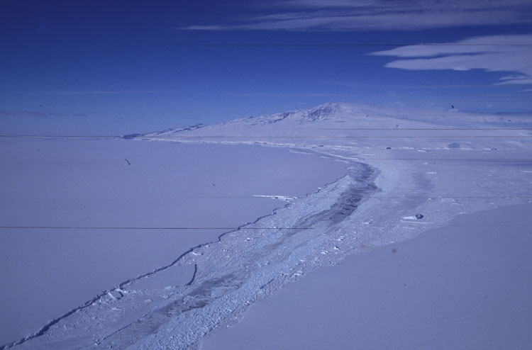
Doug, Tim, and Marianne eventually did make it down. After they arrived we went out to C16 to install 5 seismometers and then we went out to B15a to install another iceberg tracking station. The original plan had been to put one iceberg tracking station on the Drygalski Ice Tongue and another on the Ross Ice Shelf. The idea is that it is easier to "catch" the nascent icebergs while they are still attached to the continent rather than try to get to them when they're floating in the open ocean. The original plan was scrapped because the largest iceberg we are studying, B15a, broke in two in October while we were there. It broke along the crack we had seen from the helicopters when we first went to B15a in early 2001 (picture of the crack). The breakup of B15a into B15a and B15j presented a target of opportunity that we couldn't pass up. All three stations we deployed in January of 2001 wound up on B15j so we had to add a station to the new B15a.
This picture shows C16 on the right and B15j on the left. B15a is behind me to the left. You can see the rubble between B15j and C16. It is mostly sea ice that has been crunched up as the icebergs jostle back and forth but there are also some iceberg chunks. The newer sea ice is thinner and hence looks darker in this image. A combination of dirt on the helicopter window and dirt in my camera caused the streaks.