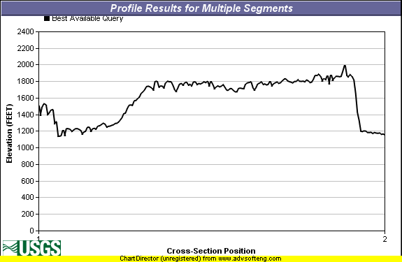
An interesting comparison of elevation profiles in Berkeley and South Dakota from the USGS seamless elevation dataset:
South Dakota
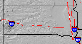
SD Profile length is roughly 260 miles. South is on the left (below).
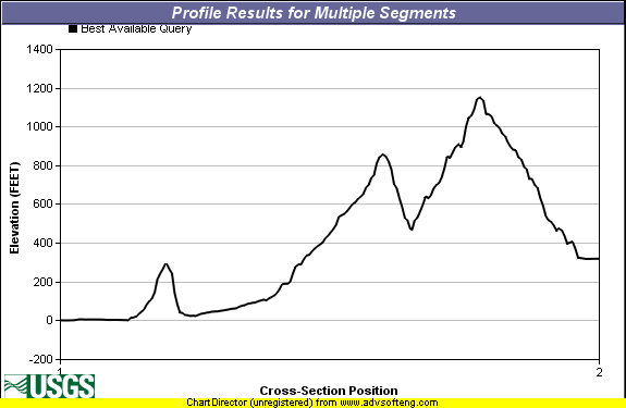
Berkeley
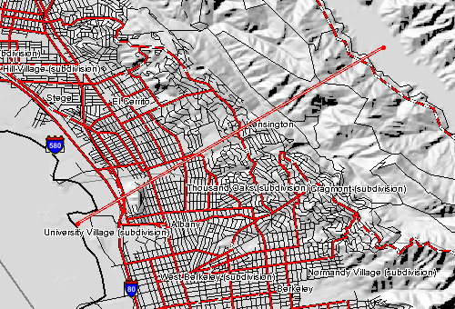
Berkeley Profile length is about 4.8 miles. West south west is on the left (below).
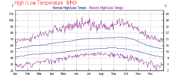
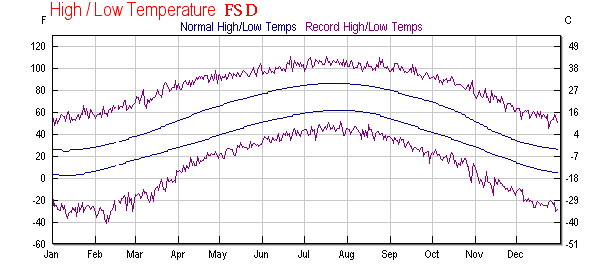
And a comparison of climatologies from wunderground: